This is the rest of the photo series by Jack Dura. For the latest posts, please see the current page.
________________________________________________________________________________________
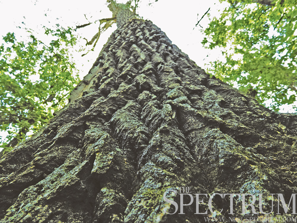
LEWIS AND CLARK COTTONWOODS
Although explorers Meriwether Lewis and William Clark and the Corps of Discovery spent over 200 days in North Dakota on their 1803-1806 expedition, very little remains as they saw it. But some sites still exist.
North of Mandan, North Dakota, at Smith Grove, a wildlife management area along the Missouri River, stands a number of cottonwood trees. Nine mammoth cottonwoods in Smith Grove are some of the last living trees to witness the Corps of Discovery’s journey westward.
Over 100 feet tall and up to 300 years old, the mammoth cottonwoods are some of the last of their kind. The Garrison and Oahe dams forever halted the natural flooding patterns of the Missouri River, harming the growing conditions for cottonwood seedlings on sunny sandbars and shorelines.
In 2003 Smith Grove’s mammoth cottonwoods were inducted into the National Register of Historic Trees for witnessing Lewis and Clark’s expedition. Though old and massive, these cottonwoods are not resistant to strong winds and harsh weather. They will bend and break. The North Dakota Game and Fish Department, which manages Smith Grove, estimates the mammoth cottonwoods have a few years left. Cottonwood trees normally live up to 100 years old.
Smith Grove is found south of Cross Ranch State Park. The grove is open for public use, including walking, camping and hunting. The 25-acre tract of river forest is mostly dominated by ash trees now, but the mammoth cottonwoods are still there, swaying against the sky as Lewis and Clark saw them.
________________________________________________________________________________________
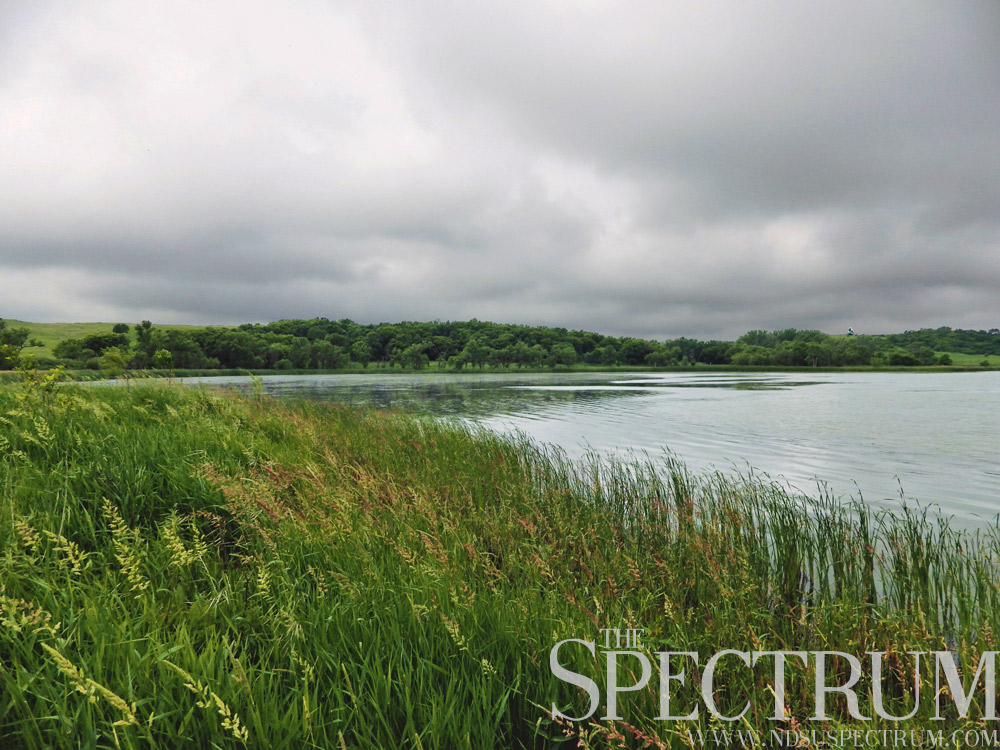
HIDDEN IN THE HILLS
In North Dakota’s smallest geographic region lies a tiny island surrounded by vast farmland.
That island is the Head of the Mountain State Nature Preserve, a 100-acre tract of land hidden on all sides by the Coteau des Prairies hills. The Coteau des Prairies is a sharp escarpment rising over 200 feet from the prairie floor, created by two divergent glacial lobes 20,000 years ago.
The tiny tip of the escarpment jutting into southeastern North Dakota makes up less than 20 square miles, at the head of the region that develops into South Dakota’s Sisseton Hills.
The Head of the Mountain preserve is a paradise for deer, waterfowl and other animals. A shallow reservoir created by the Frenier Dam adds a placid waterscape to the preserve. Walkers are encouraged, but no hiking trails are established. Hunting is allowed on the nature preserve, but only for deer with muzzleloaders or bow and arrow. Birding, photography and skiing are also encouraged.
Wildflowers abound on the preserve, from prairie roses to purple coneflowers. Bugs are bad on windless days. A cornfield circles part of the preserve, and the Coteau des Prairies Lodge sits northeast of the dam, offering agritourism, scenic views and other activities. The lodge was built three years ago with ponderosa pine logs from Slope County, N.D., nearly 300 miles away.
Seven state nature preserves exist in North Dakota, including a four-acre tract of badlands at one of North Dakota’s highest points and two acreages near the Missouri River. Along with wildlife management areas, national grasslands and other protected places, nature preserves are a blessing for animals and meant for adventures well off the beaten path.
________________________________________________________________________________________
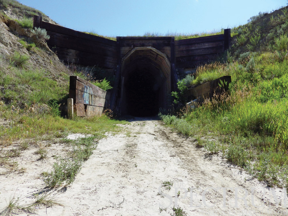
OVER THE RIVER, INTO THE TUNNEL
A hike like no other into a place all its own straddles the Yellowstone River west of Cartwright, N.D.
The Cartwright Tunnel and adjoining Fairview Lift Bridge make up a walking trail through North Dakota’s only railroad tunnel. Dug by hand out of a rugged hill, workers built the 1,458-foot tunnel from 1912-1913 using hand tools, animal-powered scrapers and blasting powder.
The 1,320-foot lift bridge, meanwhile, was raised only once. Its 570-ton lift span was raised 43 feet in half an hour in 1914. Steamboat traffic had already ended on the Yellowstone, and the lift bridge was never raised again.
Besides being the only one of its kind in the state, the Cartwright Tunnel is unique in that it allowed both railroad and automobile traffic for 40 years. Cars and trains used both the bridge and tunnel, with planking laid down for automobiles on the tracks. Phones were in place for the bridge’s leverman and motorists to be alert to oncoming traffic. Accidents did happen, but no trains were ever involved and no deaths occurred.
Passenger trains stopped using the bridge and tunnel not long after automobile traffic ceased. Freight trains used the tracks until 1986. In 1997, officials appointed the abandoned bridge and tunnel to the National Register for Historic Places due to their historical and architectural significance.
The nearby chamber of commerce soon after made the site into a trail. Afterward, the bridge’s lift span apparatus was tested. The device worked perfectly after 80-plus years of disuse.
From Sundheim Park on the Yellowstone’s west bank, the hiking trail crosses the lift bridge, adorned with graffiti and lovelocks, into the yawning tunnel decorated with more graffiti and exits on private land. Abandoned for 30 years, the bridge and tunnel are now just one of many attractions in the heart of North Dakota’s oil country.
________________________________________________________________________________________
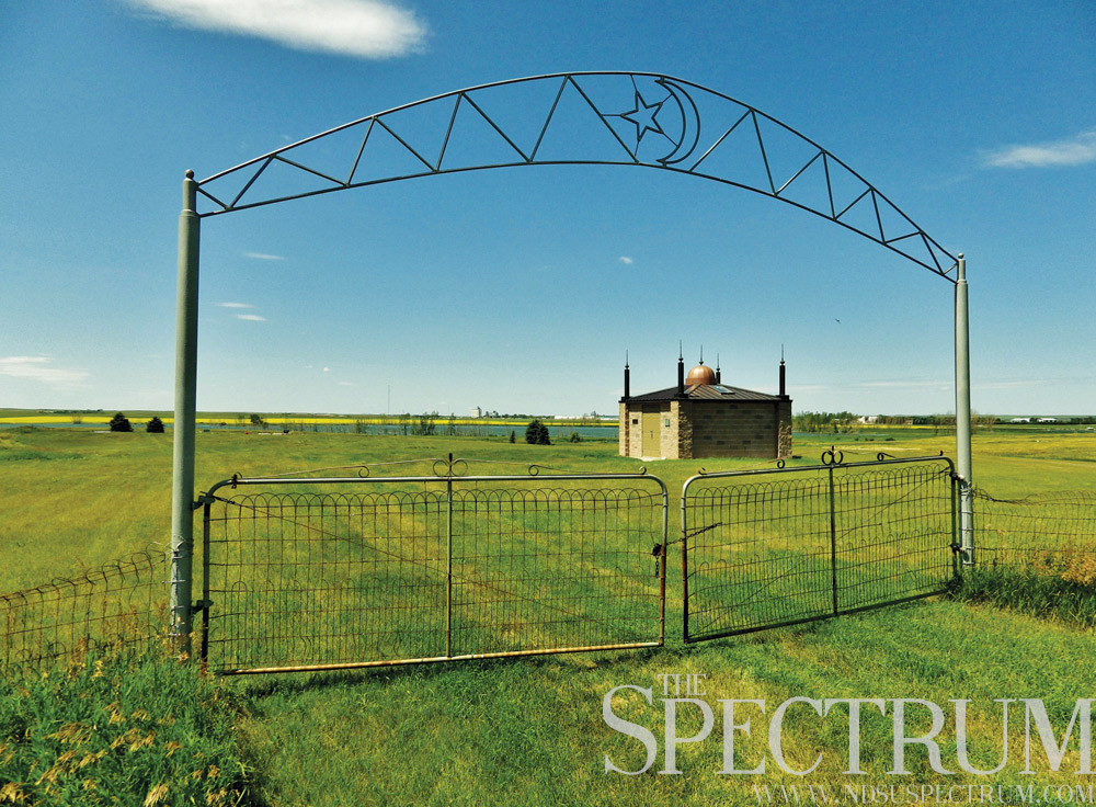
AMERICA’S FIRST MOSQUE
In a sea of canola fields and pumpjacks, something unexpected stands near Ross, N.D.
A replica monument of America’s first mosque sits one mile east of the city of 109, a memorial to the Syrian-Lebanese settlers of northwestern North Dakota. Ross was founded in 1902, and the original mosque was built in 1929 by area Muslims who left their Mediterranean homeland then under Ottoman rule. The original structure was a plain outbuilding that measured 30 by 40 feet. A lower level of the mosque kept prayers and gatherings out of the harsh winter cold.
By the 1940s, the mosque had fallen into disuse as area Muslims moved away or converted to Christianity. The building was demolished in the ‘70s. Area Muslims later sought to rebuild a new structure, and by 2005, the memorial mosque just off Highway 2 was completed. Though about four times smaller than the original building, the new mosque is sometimes used for worship. The site attracts visitors from outside states as well as various Middle Eastern countries.
Other mosques in the U.S. existed prior to the one near Ross, but the Ross mosque was the first building specifically built as an Islamic house of worship in America. Today the replica monument is mainly a tribute to the region’s Muslim settlers and the monument’s sponsors. A small cemetery sits just west of the structure.
Over 1,900 mosques exist in the U.S. today. Though long demolished, the country’s first mosque stands in silent memory on the flat plains of North Dakota among other legacies of the region’s past residents.
___________________________________________________________________________________
HIGHLIGHTING THE LOWEST POINT
Hikers and adventurers often flock to the highest points of states, like Eagle Mountain in Minnesota or White Butte in North Dakota. There’s something unique about highest points, knowing nothing is above you as you scan the horizon – but what about lowest points?
Little romance exists for low-lying areas, but every state has them. North Dakota’s lowest point is found in Pembina County at its very tip: the Red River at the Manitoba border. At 750 feet above sea level, the lowest point in North Dakota is contrasted greatly with White Butte in the southwest at 3,607 feet.
As the Red River drains into Canada, its gradient decreases 1.5 inches every mile in Pembina County. The river’s slope averages 5 inches per mile on its flow from Wahpeton, N.D., to Lake Winnipeg in Manitoba. As the former floor of glacial Lake Agassiz, the Red River Valley is one of the flattest regions on the planet.
North Dakota’s lowest point is a muddy place, accessible along a half-mile walk from the old Meridian Highway north of Pembina, N.D. The abandoned auto trail was meant to connect Manitoba with Mexico in the early 20th century, but U.S. Route 81, Interstate 29 and countless other roadways have now buried the Meridian Highway.
Walking east from an international boundary marker near the old road, anyone accessing the riverside from the auto trail (now 100th Street Northeast) is visible to the Pembina port of entry station. Border patrolmen do investigate visitors along this stretch of land, inquiring about their intentions along an international boundary.
North Dakota’s lowest point is not marked or delineated in any way. The spot is not the most tourist-friendly location with thick mud and brush and observant border patrolmen keeping a lookout on the only road that leads there.
________________________________________________________________________________________
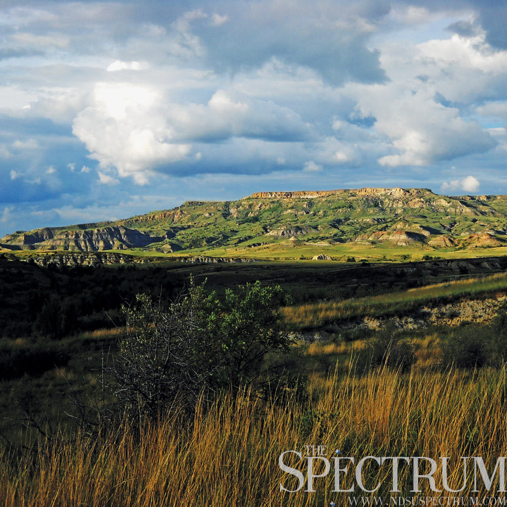
BADLANDS BEAUTY
North Dakota’s geography is about as extreme as it can get. The east’s flat expanse of the Red River Valley is sharply contrasted by the dramatic ruggedness of the west’s badlands.
Covering over 7,000 square miles of North Dakota, the badlands’ story begins where the dinosaurs’ ends: the conclusion of the Cretaceous Period 65 million years ago. As the Rocky Mountains were forming, sediments of mud, silt and sand from the mountains were spirited away to the east by ancient rivers and left there in layers.
Ash from North American volcanoes also laid down some accumulation that over time became bentonite clay. Erosion from ancient rivers stripped away the layers of sediments, and 2 million years ago, enormous continental ice sheets blocked off these north-flowing rivers – forcing them to run into the Mississippi River instead of the Hudson Bay.
When the ice retreated, the present-day Missouri and Little Missouri rivers were dead set in their northern courses. The Little Missouri’s steep course made for a fast flow, which cut away and exposed the soft sediments laid down millions of years prior. The result: the broken beauty of North Dakota’s badlands.
The geography’s name comes from French-Canadian trappers who called the landscape “les mauvaises terres à traverser,” or “bad lands” to cross.
Lakota people called the badlands “mako sika,” or “no good land.” The broken ruggedness of the landscape is indeed difficult to travel but sustains animals like white-tailed and mule deer and upland game birds. It is prime habitat for rattlesnakes with its rocky outcrops and summer heat.
Fossils of prehistoric life can be found in the former swamp and forestland that was the badlands. The Painted Canyon and Theodore Roosevelt National Park units are superb spots to view the badlands, southwestern North Dakota’s singular landscape.
________________________________________________________________________________________

IRON SPIRITS OF THE PLAINS
Sprinkled across the Great Plains of North America are cultural creations found almost nowhere else in the world. Wrought-iron crosses are a form of folk art concentrated greatest in the cemeteries of central North Dakota – primarily in and near German-Russian communities.
Germans from Russia brought the art of iron crosses, or eizenkreuzen, with them from abroad – establishing the tradition in prairie communities of the Great Plains. Prairie blacksmiths were known far and wide for their skills in constructing iron crosses, all of which are original works made by hand.
Withstanding the prairie’s strong winds and harsh winters, the wrought-iron crosses are not susceptible to crumbling or erosion like stone monuments. Most iron crosses were constructed between the 1890s and 1930s until commercial manufacturing of gravestones made the tradition unpopular.
Since 1989, many wrought-iron crosses sites have been listed on the National Register of Historic Places. Such sites – mainly cemeteries near North Dakota cities like Hague, Zeeland, Mandan and Golden Valley – are still maintained and accessible to the public like any graveyard.
What is most notable about the plains’ wrought-iron crosses is the personal touches added by the blacksmiths. Their designs and styles of ironwork are entirely unique. Though commercial gravestones began competing with the handmade crosses by 1900, the prairie blacksmiths began to develop intricate and often elaborate crosses to meet the challenge.
By the 1940s, however, the tradition declined considerably, and today all of the original cross makers are gone. Cross making does continue to this day in many of the communities where it flourished, and thousands of examples of this folk art can still be found from Saskatchewan to Mexico and particularly in North Dakota.
________________________________________________________________________________________
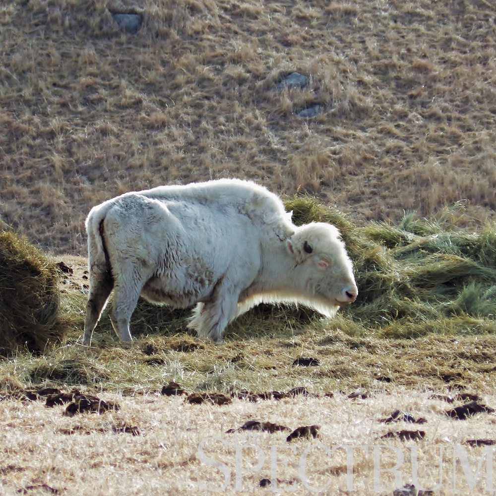
ONE IN 10 MILLION, THREE IN JAMESTOWN
North America’s largest land mammal, the bison, was once brought to near-extinction –astonishing, when the species roamed in numbers upwards of 30 million. After overhunting and slaughter reduced the bison to mere hundreds by 1900, conservation efforts restored herds to half a million or more.
Few of today’s bison are free ranging, with herds spread out across national parks and game preserves. One such bastion is found at the National Buffalo Museum in Jamestown, N.D., where 30 bison roam near Interstate 94.
The live herd includes White Cloud, an albino buffalo – a true rarity, since white buffalo occur once in every 10 million bison births.
Born in 1996 on a Michigan, N.D., farm, White Cloud, or Mahpiya Ska, is considered a sacred being in native culture, particularly on the Great Plains. American Indians travel across the continent in pilgrimage to the albino female buffalo, believing the animal to be spiritually significant.
Confirmed to be pure albino through DNA testing, White Cloud has limited hearing and vision. As of spring 2014, she has had 11 calves, one of which is a white buffalo but not albino; that calf, Dakota Miracle, was sired by Dakota Thunder, another of White Cloud’s calves. The mother and son were bred through line breeding for “certain traits.”
In 2008, Dakota Thunder sired another white buffalo, later named Dakota Miracle. Separate contests decided the names for the two white calves.
A major attraction of the National Buffalo Museum, White Cloud is leased annually to the cultural center by the buffalo’s owners in Michigan, N.D. Along with the herd and a 60-ton concrete buffalo, the largest on earth, Jamestown has earned its nickname: Buffalo City.
________________________________________________________________________________________
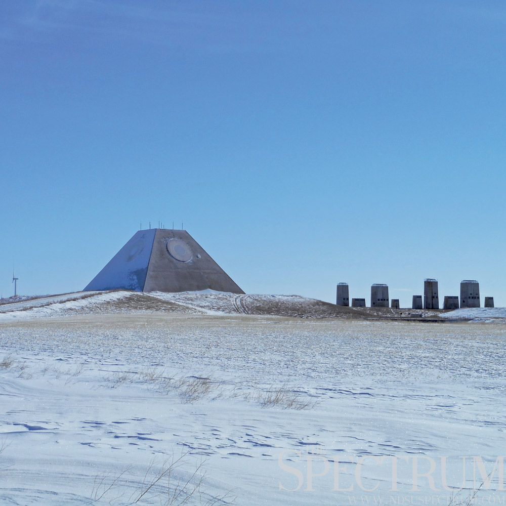
STAR WARS ON THE PRAIRIE
Just north of Nekoma, N.D., is something like out of a science fiction novel – the Stanley R. Mickelsen Safeguard Complex. The only operational anti-ballistic missile facility completed in the U.S., the SRMSC was a defense system put in place to detect and counterattack Soviet missiles during the Cold War.
Built at the cost of $9 billion in the early 1970s, the SRMSC was live for four months before Congress deactivated it in February 1976. In underground cells, the site held 30 Spartan and 12 Sprint missiles – nuclear-tipped missiles capable of intercepting and detonating incoming attacks at long and short ranges.
A prominent radar pyramid served as the site’s command and control center and was responsible for detecting incoming attacks. A Perimeter Acquisition Radar site on a base near Concrete, N.D., located and tracked incoming objects, predicting points of impact through its data processor, then relayed it back to the SRMSC. The PAR site is currently operated by the U.S. Air Force as part of the Spacetrack missile warning system.
In its heyday, it took 1,200 maintenance and personnel to operate the SRMSC. This included a barracks, administrative and industrial buildings, gym, community center and chapel in addition to the radar pyramid, its intake and exhaust structures and the missile silo field.
In 1977, the SRMSC’s missiles were removed, its silos sealed and buildings cleaned out and closed. Abandoned since 1978, the site went up for auction in 2012, later purchased by the Spring Creek Hutterite colony of Forbes, N.D., for $530,000.
A legacy of North Dakota’s role in the Cold War, the SRMSC is hard to miss on the horizon of Cavalier County. While the only base of its kind to go live, missiles still remain in North Dakota, with 150 Minutemen 3 intercontinental ballistic missiles maintained by the Minot Air Force Base.
________________________________________________________________________________________

THE KING OF TREES
The cottonwood tree is near and dear to the state of North Dakota, from its use as farm windbreak to providing shade to its culinary and medicinal purposes by Native Americans. Lewis and Clark used cottonwoods more than any other tree, utilizing the species to make axles, wheels and canoes during their expedition.
Cottonwoods are North Dakota’s largest trees, as well as the fastest growing, so it should come as no surprise that one specimen is the state’s largest and tallest tree. Found on a farm south of Sheldon, N.D., the cottonwood is 115 feet tall.
The specimen is about 205 years old and 26-feet-6-inches around at its trunk. Last July it and several other trees in the area were struck by lightning, and while nearby trees burned, a large section of wood was split off the side of the king cottonwood. Despite the injury, the tree is still the largest.
The tree’s owners have lived on the property since 2003 and have fielded many requests from people wanting to see the cottonwood, some coming from as far away as Wyoming and Texas.
While this tree is the largest and tallest in North Dakota, it is not the oldest nor the widest around; those respective honors belong to a cottonwood near Horace, N.D., at 28-feet-7-inches around, and the Smith Grove acreage north of Mandan, N.D., whose cottonwoods are between 250 and 300 years old (some of the oldest in the state).
Having withstood years of weather and wind on the beautiful yet unforgiving prairie of eastern North Dakota, the cottonwood near Sheldon is a strong and old one indeed. While most cottonwood trees live 70 to 100 years, the species has the potential to live up to 400 years if the growing environment allows it.
________________________________________________________________________________________
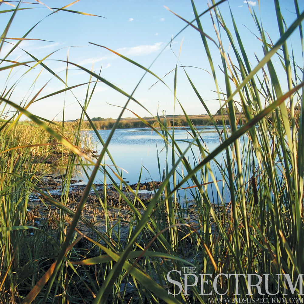
PRAIRIE POTHOLE PARADISE
The Prairie Pothole Region of central North America encompasses over half of North Dakota, making the landscape a prime habitat for migratory waterfowl and other wildlife.
Glaciers that retreated from the area over 12,000 years ago left a land pitted with prairie wetlands and thousands of sloughs, covering 300,000 square miles of southern Canada, the Dakotas, Minnesota and tips of Montana and Iowa. The habitat is an interesting one, characterized by fluctuating wet and dry periods and a highly influential hydrology.
Though it makes up only 10 percent of waterfowl breeding habitat in North America, the Prairie Pothole Region is visited annually by over 50 percent of the continent’s breeding waterfowl population.
Nearly 5 million acres of North Dakota were once wetlands, but agricultural converstion of the landscape took its toll, and today less than 2.4 million acres remain. Ducks Unlimited, the world’s leader in wetlands conservation, has worked with sportsmen, landowners, scientists and state officials to preserve the habitat of North America’s migratory waterfowl since 1937.
Last year, the organization protected over 35,000 acres of the Prairie Pothole Region, and restored nearly 21,000 acres of the same area.
More than half of America’s original wetlands have been lost to farmland, development, infrastructure and pollution. Rich and vital for waterfowl nesting and feeding, the Prairie Pothole Region is a critical piece of habitat for North America’s migratory waterfowl, and a defining yet fragile feature of the state of North Dakota.
________________________________________________________________________________________
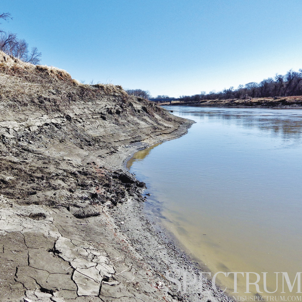
BANKS OF THE MISSOURI RIVER
For nearly 400 miles, the Missouri River winds through North Dakota on its 2,340-mile flow from Montana to Missouri. Only 80 miles of that length are free-flowing, as construction of the Garrison and Oahe dams flooded the overlying land, creating the manmade reservoirs of Lake Sakakawea and Lake Oahe.
Throughout the past 200 years, the river has played an important role in the settlement of North Dakota. Explorers Meriwether Lewis and William Clark camped near the Missouri by the Mandan and Hidatsa villages, wintering at Fort Mandan near present-day Washburn, N.D., from October 1804 to April 1805.
It was here they met Sacagawea, the Shoshone teenager who helped as a translator and guide on the Corps of Discovery’s journey west. When the expedition returned to the Indian villages in August 1806, the explorers found the fort burnt to the ground. A reconstruction of the fort stands near Washburn today, while the site of the original Fort Mandan lies under the river’s waters.
In June 1832, the steamboat Yellowstone sailed into the mouth of the Yellowstone River on the Missouri, southwest of present-day Williston, N.D. In the decades to follow, cities like Bismarck, Mandan, Williston and Washburn sprang up near the Missouri’s banks, growing to be some of North Dakota’s largest communities.
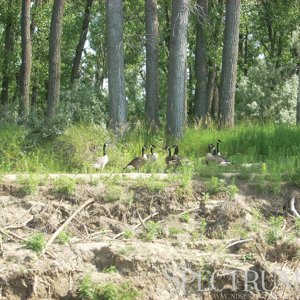
Wildlife abounds on the river, from walleye to paddlefish to Canada geese to the endangered least tern and pallid sturgeon.
There is much to see and do around the river, from fishing and birding to touring Washburn’s Lewis & Clark Interpretive Center to exploring the Knife River Indian Villages National Historic Site near Stanton, N.D.
The mighty Missouri is a river that has reigned as North America’s longest and one that will always be legendary in North Dakota.
________________________________________________________________________________________
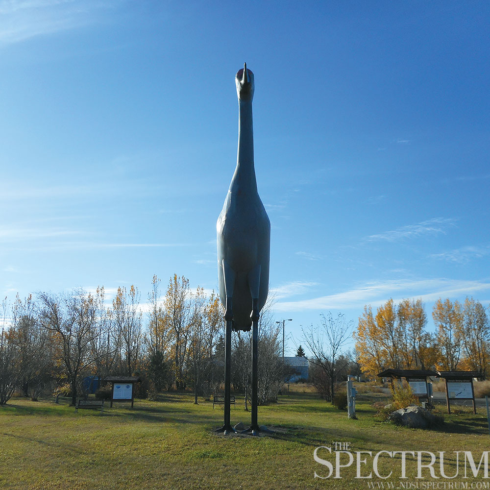
STEELE’S SANDHILL CRANE
In the central flyway of North American migratory wildlife is a monument to the world’s oldest species of bird: the sandhill crane.
Sandy, the world’s tallest sandhill crane, stands in Steele as testament to the bird’s preference for nesting in the Coteau rangeland of central North Dakota. At 38.5 feet tall, the statue is 10 times larger than the actual bird, welded into existence by ironworker James Miller of Arena, N.D.
Completed in 1999, Sandy is constructed of a steel inner framework with rolled sheet metal welded into place and painted. With legs made of pipe, the bird was fully assembled in Miller’s shop then transported to the site near the former Lone Steer Motel.
As a highlight attraction off Interstate 94’s Exit 200, Sandy was a site to see at the Lone Steer Motel for years until the building was completely destroyed in an arson fire in August 2012.
Allen Thomas, a road worker from Texas, was sentenced in 2013 to 46 years in prison for the 19 charges against him for the fire, including 18 counts of endangering by fire and one felony count of arson.
Thomas was said to have burned down the motel after its owners reportedly hid his girlfriend from him and offered her a place to stay and work following an altercation between her and Thomas.
After the rubble was cleared away (and another hotel built on the burn site), Sandy was spruced up and is maintained by the World’s Largest Sandhill Crane Foundation, a non-profit organization in Steele.
In coordination with the crane statue, the U.S. Game and Fish-Long Lake Refuge donated funds toward construction of nearby birding kiosks and provides tours of local wildlife refuges and nesting areas in south central North Dakota.
________________________________________________________________________________________
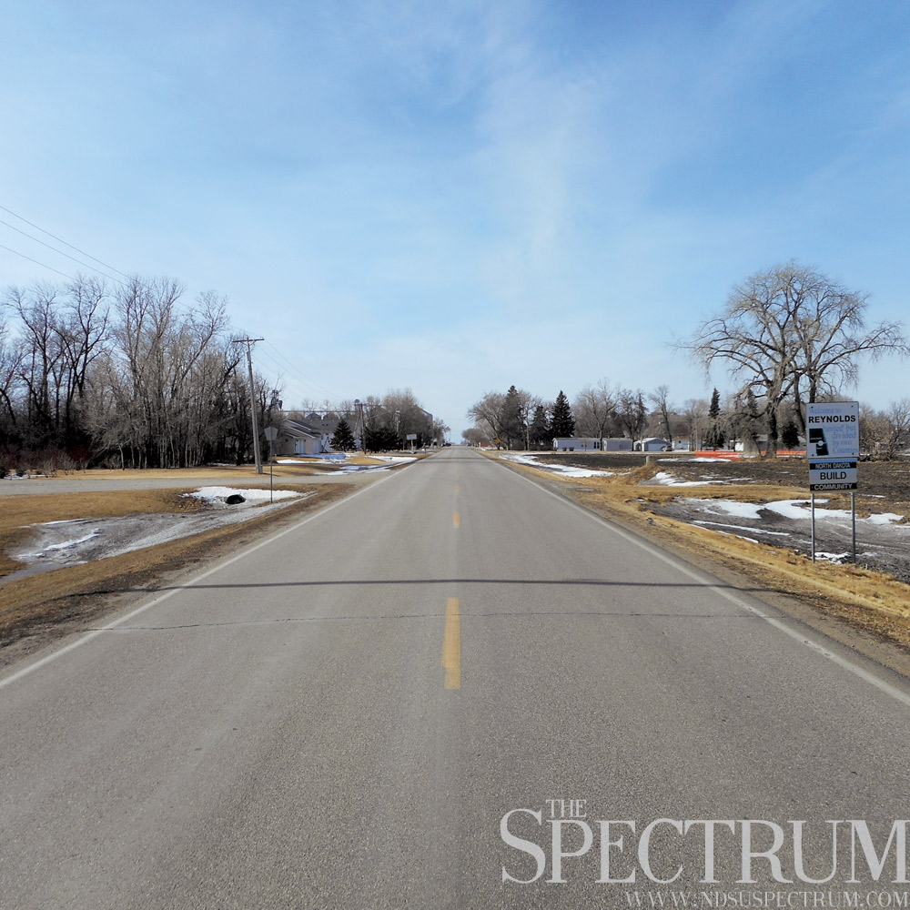
A CITY ON THE EDGE
Take County Highway 25 west from Interstate 29 and you’ll find Reynolds, a city that is only one of a few of its kind in North Dakota.
Reynolds, N.D., is found on the boundary of Traill and Grand Forks counties, sitting right on top of the county line. The city, founded in 1880 by a Civil War surgeon, is largely an agricultural community with soybeans, sugar beets and other crops all grown in the area.
Founder Henry A. Reynolds, a temperance advocate, set a stipulation into the city’s abstract of title, “… that no ardent spirits or intoxicating liquors should be given, distributed or vended on this property, or else the property should revert to the original grantors.”
Since the early 20th century, Reynolds has enjoyed a fairly steady population and today is home to about 310 residents.
There are six other cities in North Dakota that sit atop county lines, including nearby Grandin, which straddles Cass and Traill counties.
It’s a position on the map that does come with its hassles, as county regulations can vary greatly just by stepping across the street.
When Steve Hunt, deputy sheriff of Traill County, ran unopposed for Traill County sheriff last fall, he had to move his family five blocks south to be able to run for office. A North Dakota law mandates county sheriffs reside in the jurisdictions they serve, creating an interesting obstacle when Hunt considered running for county sheriff.
As a city straddling two counties, the unique placement of Reynolds, N.D., is something most people probably never ponder. Its citizens, however, let all those passing through know just where they are with signs on both ends of town touting a message of local pride:
“Welcome to Reynolds, ‘united’ but divided by two counties.”
________________________________________________________________________________________
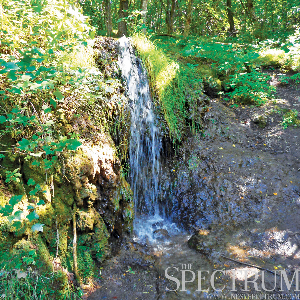
SHEYENNE STATE FOREST WATERFALL
The Sheyenne State Forest in southeastern North Dakota is home to many natural curiosities, but none as unique as its waterfall — the only natural one known in North Dakota.
Found at the end of a 2.5-mile hike along the North Country Trail, the state’s only waterfall is tucked away deep in the bowels of the Sheyenne River Valley. The thick forest that surrounds it is almost surreal in a state dominated by rough oil country in the west and flat, open farmland in the east.
A fragile system, the waterfall is powered by a small spring that plunges the overhead ground’s oozing water six or seven feet into a small pool below. From there, the water slides down a muddy bank into a creek that runs adjacent from a small campsite at the trail’s end.
Visitors to the waterfall are advised to respect its uniqueness and not impact the system in any way. This includes packing out all litter from the campsite and not harming the waterfall by foot traffic or close contact.
Designated as one of the seven natural wonders of Ransom County by county officials, the waterfall has its place among other curiosities such as a mineral springs, an endangered orchid and some of the last acres of native tallgrass prairie in public ownership in the U.S.
_________________________________________________________________________________

DEVILS LAKE INUNDATION
Devils Lake, an inland sea in northeast North Dakota, is a body of water that testifies to what can happen to a closed basin with no natural outlet for drainage.
Heavy spring precipitation in the ’90s and flooding in the years since have led Devils Lake to increase seven times in volume since 1993, hitting a record elevation of 1,454.3 feet in June 2011.
Rising waters have swallowed up roadways, farmland, trees and campgrounds. Even cities are no match for the growing lake, which has penetrated Churchs Ferry and laps at Minnewaukan.
At 1,458 feet, Devils Lake naturally overflows into the Sheyenne River. It’s an occurrence that has already happened twice in the last 4,000 years, but one the U.S. Army Corps of Engineers and state of North Dakota have contingencies for.
Manmade outlets and levees are in place for the region surrounding the lake, including a protective control structure at the Tolna Coulee, a levee at Minnewaukan and outlets on the east and west ends of Devils Lake.
While area residents have had to live and adjust to the lake’s rising waters, the future of Devils Lake is uncertain. Geologists have predicted that if the water in the lake basin is not drained, Devils Lake will keep rising to 1,460 feet. At this point the Sheyenne River will swell to 20 times its channel capacity, devastating those who live downstream and completing cutting off access to the Devils Lake region.
_________________________________________________________________________________
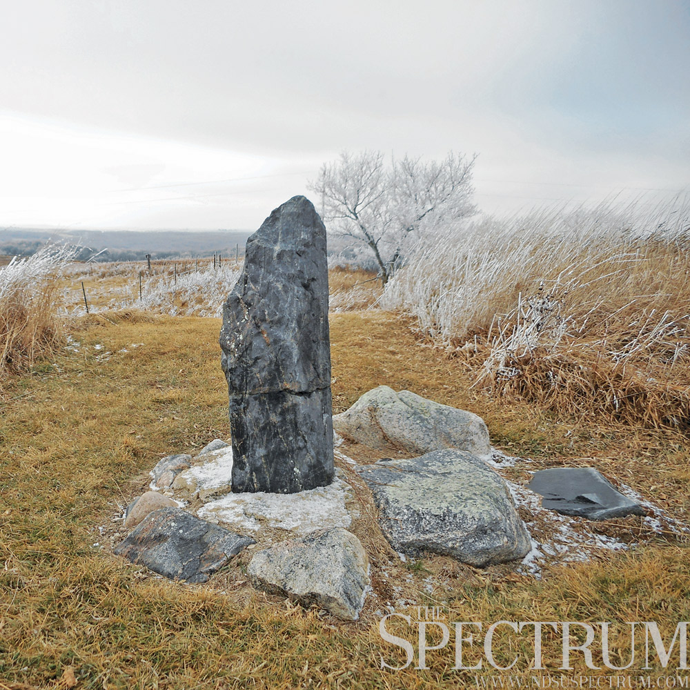
STANDING ROCK HISTORIC SITE
The Standing Rock historic site in northwestern Ransom County is a little-known spot often confused with a monument of the same name in Fort Yates. While very secluded and seemingly rarely visited, this centuries-old landmark lays claim to some of the oldest history and most scenic views in the state.
A site dating back over 2,000 years, French geographers Joseph Nicollet and John Fremont first charted Standing Rock in 1839 during their exploration of the Upper Mississippi River. They marked the spot on their maps as “Inyan Bosndata,” a phonetic spelling of the Santee Sioux phrase for “standing rock.”
Situated on an isolated hill in the heart of the Sheyenne River Valley, the Standing Rock monument itself is a 4-foot tall, conical piece of metamorphic gneiss transported by a glacier to the area 14,000 years ago during the Wisconsinan Ice Age. The area that would become North Dakota was nearly completely covered with ice at the time.
Ancient native people used the site for ceremonies and offerings, and the thrust moraine on which Standing Rock sits is one of four burial mounds in the immediate area. These prehistoric cemeteries have never been excavated and are protected by law from disturbance.
From the site of Standing Rock, one can see for miles into the Sheyenne River Valley, a scenic stretch of land that encompasses unique natural features found nowhere else in the state. Standing Rock has been deemed one of the most pictorial and historic spots in North Dakota. While the barely noticeable turn is easy to bypass on Highway 46, the views and value of the site warrant a detour.
_________________________________________________________________________________
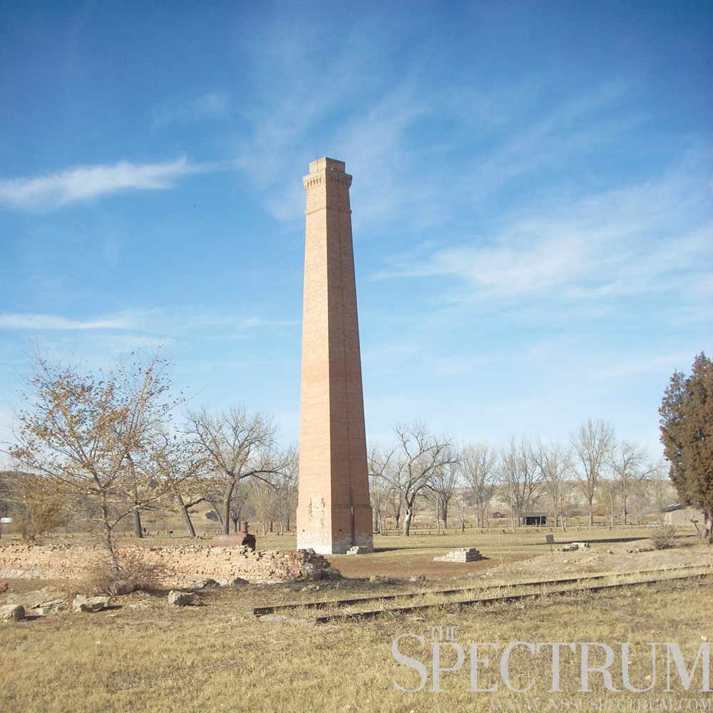
CHIMNEY PARK IN MEDORA
The remains of the Marquis de Morès’s beef empire can be found in Chimney Park in Medora, a historic little spot backdropped against a spread of badlands to the north.
De Morès came to western Dakota Territory in 1883, founding the town of Medora that spring, where he launched an entrepreneurial empire over the next couple of years.
A French aristocrat who married into a wealthy banking family, he was able to fund such ventures as beef ranching, a stagecoach line, sheep ranching and shipping salmon from the West Coast. The wily entrepreneur also pondered such enterprises as pottery and cabbage farming in the Medora area.
His time in the badlands was marked by numerous assassination attempts by locals, a murder charge for which he was tried and acquitted three times and implicitly challenging a young Theodore Roosevelt to a duel.
An anti-Semite to his core, the Marquis claimed he was the victim of “a Jewish plot” for the failure of his beef empire and his persecution in French politics. He closed his operations in Medora in 1889, and was assassinated by native tribesmen in North Africa seven years later.
The sprawling workhouse that was once his packing plant burned in 1907, and all that remains is a boiler, a rail spur, remnants of the ice houses and the yellow brick chimney, all ghosts of an empire that died not long after it was born.